
Alumni Reflections: Esaie Dufitimana
- Esaie Dufitimana, YouthMappers Alumnus
- Aug 5, 2021
- 2 min read
Updated: Aug 19, 2021
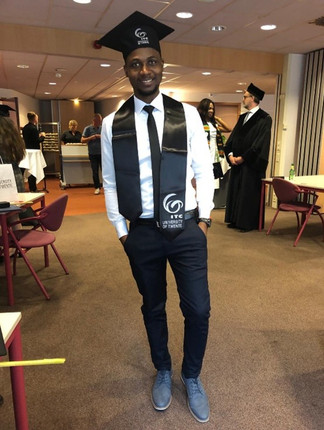
I am a Geoinformation Science and Earth Observation enthusiast with skills in Land Informatics, Geoinformation Science, Remote Sensing, Land Administration, Spatial Data Science, Photogrammetry, Spatial databases and Computational Environmental and urban science. I hold a Master of Science degree in Geoinformation Science and Earth Observation from the University of Twente, the Netherlands, recently having graduated on the 16th of July 2021.
Before heading to the University of Twente, I earned a Bachelor of Science degree with Honors in Land Administration and Management from the Institut d’ Enseignement Superieur de Ruhengeri (INES-Ruhengeri) in Rwanda, where I also won the best performing graduating student with the highest grades. I joined INES-Ruhengeri after spending a couple of years following a drop out of Computer Science bachelors studies at the University of Rwanda due to financial constraints.


From June 2019 until October 2020, I was working as a Global Forest Watch (GFW) Tech Fellow under the World Resources Institute. During my fellowship, I developed a customized forest monitoring system for Nyungwe and Gishwati-Mukura National Parks in Rwanda, which combines Hansen global datasets (tree cover loss, gain, and GLAD alerts) with region-specific earth observation and other spatial data. Moreover, before joining GFW, I was working as an Environmentalist and GIS professional with Green Cover Initiative Rwanda, where I was applying spatial technology for environment and natural resources management and land use monitoring and evaluation.
Furthermore, I was the member and chapter officer of the YouthMappers chapter at INES-Ruhengeri (YouthMappers at INES-Ruhengeri) from its start in 2017 and later. I was also selected as a YouthMappers Leadership fellow in 2019. Till today, I am in touch with YouthMappers at INES-Ruhengeri by providing advice and training for members.
I am passionate about working on methods and strategies for solving global challenges. I am interested in applying Artificial Intelligence in GIS (GeoAI) and developing GeoICT tools and their applications in urban systems, urban deprivation, land management, environment and natural resources management. My interests were motivated by the current global challenges, mainly rapid urbanization, environmental degradation, food insecurity and climate change.
Currently, I am currently working as an independent consultant and a freelancer looking forward to new challenges. I am open to doctoral studentship position, GIS engineer, GIS developer, spatial data scientist, computational urban and environmental scientist. Connect with me on LinkedIn, @EsaieDufitimana, and at dufitesaie91@yahoo.com!


He has tried very hard. I quite admire him.
dinosaur game