

LIVES ARE SAVED
Knowing where to go in a disaster can save lives. Maliha Binte Mohiuddin knows that the cyclones and resulting floods that are a frequent occurrence in her home country of Bangladesh are particularly dangerous for many women.
Women are often less mobile and may not have knowledge of or reasonable access to places to shelter. Studying disaster management and vulnerability studies at the University of Dhaka, Maliha has turned to the use of mapping technologies to teach women how to navigate these hazards, and save lives.
She devised and led a study that interviewed displaced women in a slum in Dhaka’s Moghbazar area about responses during such life-threatening events. She explored the impact of geographic knowledge, and also mapped indicators of mental stress and stress triggers. She relied on street-view imagery from the Mapillary platform, and deployed the KoBoToolbox to collect geolocated survey data. Because of limited connectivity, she worked with the Field Papers tool to easily move from a paper-based system to an online mapping database.
Sharing this knowledge and technical know-how more broadly, Maliha organized workshops at the State University of Bangladesh and Daffodil International University where she taught other women students about disaster mapping using local examples such as with flood resilience in Noakhali. She has been an ambassador of this work in the Philippines and Japan as well, to spread these life-saving ideas. The light of true leadership will be reflected in our work,” she says. “Mapping makes me feel like the global citizen that I am.”

-
Explore her story as a National NGO Program on Humanitarian Leadership
-
Listen to her speak about her YouthMappers Regional Ambassador adventures
Thanks to Maliha Mohiuddin, Nowshin Afrose and Sabiha Muna and all the YouthMappers and alumni among the twelve chapters across Bangladesh, including University of Dhaka, Dhaka College, Eastern University, Jahangirnagar University, Asian University of Women, Daffodil International University and State University of Bangladesh, as well as host institutions in the Philippines and Japan.

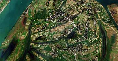
A changing climate is already affecting millions of people who are experiencing increasing intensity and frequency of large hurricanes and cyclones. Finding shelter during these natural disasters is critical for everyone. Special attention should be paid to women who most often are in charge of care for their households and children, including that they are aware of the location of shelters, have transportation access, and communication warnings in advance. The different mobility behavior, access to transportation, and communication network of women in vulnerable households put them at special risk not only for the extreme weather events, but also the aftermath effects of severe flooding, sanitation, food insecurity and other cascading effects.
More pervasive and inclusive use of mapping tools like those that Maliha teaches to vulnerable communities promises to increase the number of women who can use them to respond in disasters. Improved location data of shelters and other features like hospitals, attributes such as what kind of health care, how many beds, and other details all add up to significantly aid humanitarian efforts in situations such as cyclones, but also other slow-moving outbreaks like malaria or the COVID pandemic. This saves countless lives.
We understand that everywhere she maps, she makes a difference.
These mapping and data collection efforts, led by female emerging student leaders in the YouthMappers network, hold the potential to benefit millions around the world by making available critical, mapping data relevant to half the world’s population, so that security improves, lives are saved, power is generated, prosperity rises, and innovation happens.