
Greetings from Manila and thanks for helping Map the Philippines!
- FEU Tech JPCS YouthMappers Chapter
- Feb 27, 2017
- 1 min read
Our newest chapter, from Far East University Institute of Technology, sends their greetings to all! We welcome them ....
And we thank YOU all for helping with the first featured remote project of 2017 for Map the Philippines.
In January, our friends at Map the Philippines (MapPH) asked for our assistance in
completing some very important tasks by this month (February), and they really appreciated your help.
Map the Philippines (MapPH) is an international community working together with free mapping tools to help citizens, NGOs, business, schools, and government work better together to strengthen the resilience of our cities.
The MapPH.com platform is a free and open source, open data platform that maps real time community needs, tracks public and private programs and services, and layers risk data within the framework of the UN Sustainable Development Goals. We teach people how to map with free mapping tools and how to report public and private sector needs. By layering data, we help visualize priorities, overlaps and gaps, to help stakeholders make more informed decisions about our communities.
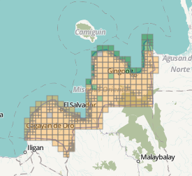
Together with the Department of Science and Technology's Project NOAH (Nationwide Operational Assessment of Hazards) the mapping in three high disaster risk areas was completed, and YouthMappers from around the world and in Manila too helped contribute! Congratulations!
We still need validators for these tasks, but take a look - they are complete! (Click on the image to go to the task):


Comments