
GEOROUTE: Empowering Students Through GIS-Based Transportation Analysis in Cagayan de Oro City
- Joyce Mae R. Callao
- Jun 18, 2025
- 4 min read

In May 2025, I was invited to speak at an event organized by the 2nd-year Geodetic Engineering students from the Department of Geodetic Engineering. As a 4th-year BS Geodetic Engineering student, I was honored to take part in this student-led initiative that aimed to explore how GIS can help solve real transportation challenges in Cagayan de Oro City.
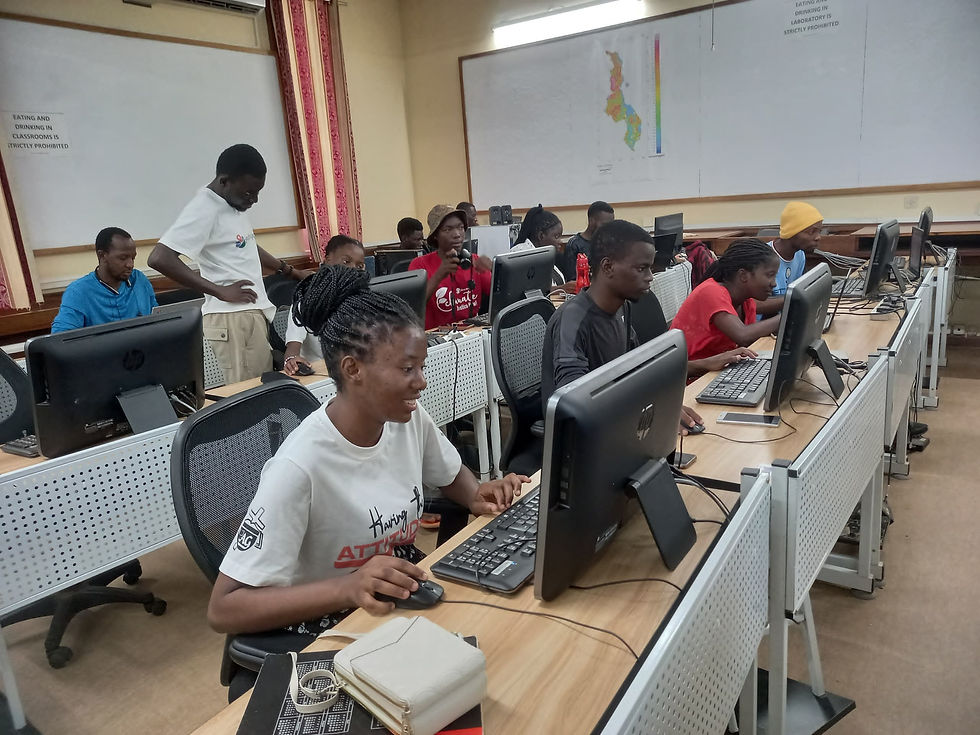
The event had three main parts: in the morning, I presented “GIS Applications in Urban Transport Planning” and a technical session on “Traffic in Cagayan de Oro City.” This initiative was based on a 2nd-year student paper on GIS transportation network analysis in Cagayan de Oro City. Though not presented, it guided the event’s theme and helped explain GIS in urban mobility. In the afternoon, I led a hands-on QGIS workshop on service area analysis, teaching how to map catchment areas by travel time and distance.

Urban mobility is a growing concern in Cagayan de Oro. Like many developing cities, it faces issues such as narrow roadways, poor land use, traffic congestion, illegal parking, and a lack of efficient public transportation options. These problems affect not only travel times but also access to essential services.
One thing I realized during the event is that only a few students truly understood what GIS is, what it does, or how it works. Some were not even familiar with the basic software or types of data used in GIS. For many, it was their first time hearing about spatial analysis, network modeling, or service area tools. That gap in awareness made this event even more meaningful — it was a chance to introduce something powerful yet underutilized.

During the technical session, we tackled these challenges with data-backed research. The referenced 2nd-year paper revealed key transport bottlenecks in the city through spatial network analysis. It highlighted how disconnected road segments and poor connectivity contribute to congestion and inefficient routes — a situation commuters experience daily.
My presentation focused on how Geographic Information Systems (GIS) can help us visualize, analyze, and address transport-related issues. I introduced tools such as QGIS, ArcGIS, and Google Earth Engine, which enable us to map traffic flow, identify problem areas, and simulate network improvements.
I also shared insights from our own thesis project, SWaRM (Solid Waste Route Mapping), which used GIS to optimize garbage collection routes in Barangay Bulua. The approach used in SWaRM can be applied to transportation — identifying efficient paths, minimizing fuel use, and improving service coverage.

In the afternoon, the QGIS workshop gave participants practical experience in service area analysis. We looked at how far people could travel from key points — like terminals within specific time frames. It was great to see the participants gain confidence in using geospatial tools to tackle real-world scenarios.
This event was a great example of how collaboration across year levels can create a powerful learning experience. The technical sessions provided context, while the workshop translated concepts into action.
Students who had little to no GIS background became interested in using spatial tools for their own projects. Many were surprised at how accessible open-source platforms like QGIS are and how useful they can be even for basic urban analysis.
More than just a learning session, this event created awareness that GIS is not just a tool for mapping but for decision-making.


Speaking and facilitating a workshop in front of a large audience was, once again, a significant challenge for me. It pushed me out of my comfort zone and taught me the art of simplifying technical details without diluting their essence.
As a speaker and workshop facilitator, I learned the importance of keeping explanations clear and relatable, especially when introducing technical content to younger students. It challenged me to simplify without oversimplifying.
The experience also reminded me of the power of clear communication, patience, and collaboration. Great ideas can come from any level, and it’s inspiring to see the 2nd-year students demonstrate strong analytical thinking and genuine concern for our city. With more guidance and exposure, they can lead even bigger initiatives in the future.

This event is just the start. I’m planning follow-up workshops to dive deeper into network analysis, accessibility mapping, and even transport modeling. I’m also hoping to connect with local government offices to explore how these student-led outputs can support actual planning and policymaking.
GIS gives us the ability to make invisible problems visible. And when we see clearly, we can act wisely. I am proud to have been part of this event — not just as a speaker, but as someone helping to build a more spatially aware and empowered community of future planners.

About the Author

Joyce Mae R. Callao is a senior student pursuing a Bachelor of Science in Geodetic Engineering at University of Science and Technology of Southern Philipppines. Joyce is a 2024 YouthMappers Leadership Fellow and a YouthMappers Volunteer Regional Ambassador.
Connect with USTP:


With just a few clicks, Incredibox Game turns beatboxing into pure creative fun, letting you mix sounds, layer rhythms, and craft tracks that feel like your own personal jam session.