
OUR JOURNEY WITH UNIMA YOUTHMAPPERS 2024
- MACLEAN NYASULU,AUBREY MTETEKA , TAMANDAN SAITI, KELLINESS CHIPETA, WINNIOUS GONDWE, RHODA MHONE
- 4 hours ago
- 7 min read
Acknowledgment: This post was delayed in publication and may contain outdated information. We appreciate your understanding.
My adventure with University of Malawi YouthMappers Chapter (UNIMA) began in 2022 when I first joined the University of Malawi. As a new student, I was eager to explore opportunities and contribute meaningfully. Little did I know then that this organization would become such a significant part of my university life and personal growth. When I first joined, I was just an eager member, learning, attending training and meeting like-minded individuals.
Building Our Online Presence
My initial experiences laid a strong foundation, and soon I became involved with the media team, capturing and sharing our activities and accomplishments on social media platforms like:
In Preserving the Chapter Legacy
Author: Maclean Nyasulu, UNIMA Chapter President
During my time as President of the UNIMA chapter, I was inspired by the efforts of fellow former chapter presidents and decided it was time for our chapter to create its own impactful project. Together with Rory Nealon, the Senior GIS Analyst & YouthMappers Activity Manager at the Innovation, Technology & Research Hub (ITR), we devised a project to map houses around Chikanda in Zomba using TechOSM. This project was the culmination of our training, and it filled me with pride to see our plans come to life.
The project was not just a testament to our skills but also a training ground for our newly recruited members. These enthusiastic individuals were eager to contribute and learn. We used the project to train them, and the experience of mapping the off-campus student residential areas was both educational and exciting for everyone involved. It was heartening to see the new members enjoying the process and gaining practical skills that would benefit our community.
This endeavor was not only a significant achievement during my presidential term but also a fulfilling experience that brought our chapter closer together. The success of mapping Chikanda, Zomba, highlighted our commitment to making a difference through mapping, and I am incredibly proud of the hard work and dedication shown by all members involved.
In my ruling time as president of the chapter, I managed to create a UNIMA OpenStreetMap Wiki where the full background history of the chapter is published. On this website, it consists of the full history from when it started until the present day.
The UNIMA OpenStreetMap Wiki is a living document that will continue to grow with our chapter. I encourage all current and future members to engage with the wiki and contribute to its content. This project embodies our commitment to transparency, collaboration, and the power of mapping to bring about positive change. I'm proud to have played a role in preserving our chapter's history and look forward to seeing it inspire our community.
Tackling Plastic Pollution Through Mapping
Author: Aubrey Mteteka, UNIMA Chapter Member
One of our chapter's most remarkable achievements was leading the motion against thin plastics, a critical environmental issue affecting both our campus and surrounding communities. On Wednesday, November 16, 2024, in collaboration with the UNIMA Geo-science Society, we organized a campus-wide cleanup activity. This initiative, brought forward by UNIMA WES, saw various university societies come together to address environmental degradation caused by thin plastics. By mapping the best locations for tree planting, we ensured the activity had a lasting environmental impact. These efforts also helped demonstrate the role of geospatial tools in addressing environmental challenges.

As a YouthMapper, I also took the lead in facilitating discussions with our peers about how mapping can create a conducive environment. We explored innovative ideas such as mapping the best locations for pit latrines to improve sanitation and identifying areas where tree planting would have the most significant environmental impact. These conversations not only enriched our chapter but also inspired actionable steps among participants.
A Historic Moment: State of the Map Malawi 2024
Author: Tamanda Saiti, UNIMA Chapter Vice President

As a member of the UNIMA YouthMappers Chapter, it was a great honour to attend the first ever State of the Map Malawi, themed "Reflecting on the growth of the geospatial industry in Malawi and the path towards fulfilling sustainable development." The two-day conference took place from the 18th to 19th of July, 2024, and brought together various dignitaries who featured in a lot of activities such as mapathons, presentations by various personnel, and Google Earth Engine training.
For example, the presentations were given by the chairman of the organizing committee, Mr. Patrick Ken Kalombe, on his PhD research on how he has used GIS and OSM to monitor the trash in the township of Ndirande in Blantyre city. Another presentation was given by a Ugandan HOT Tasking Manager representative on how HOT Tasking Manager and OSM were used to help villages in the southern part of Malawi that experience frequent flooding by equipping them with resources for disaster management. These activities were so innovative and empowering, and they motivated me.
Another highlight was the African Drone and Data Academy (ADDA). The ADDA enlightened us more on drone technology and how they used drones to work together with the Malawian government, the department of disaster risk management and response, and on the trainings on drones that they do. All in all, being a part of this historic moment of the first ever State of the Map Malawi has got me thinking of ideas on how I can also bring an impact to the geospatial industry in the country to help towards the path of sustainable development.
Building Technical Skills: From QGIS to JOSM
Author: Rhoda Mhone, UNIMA Chapter Vice Treasurer
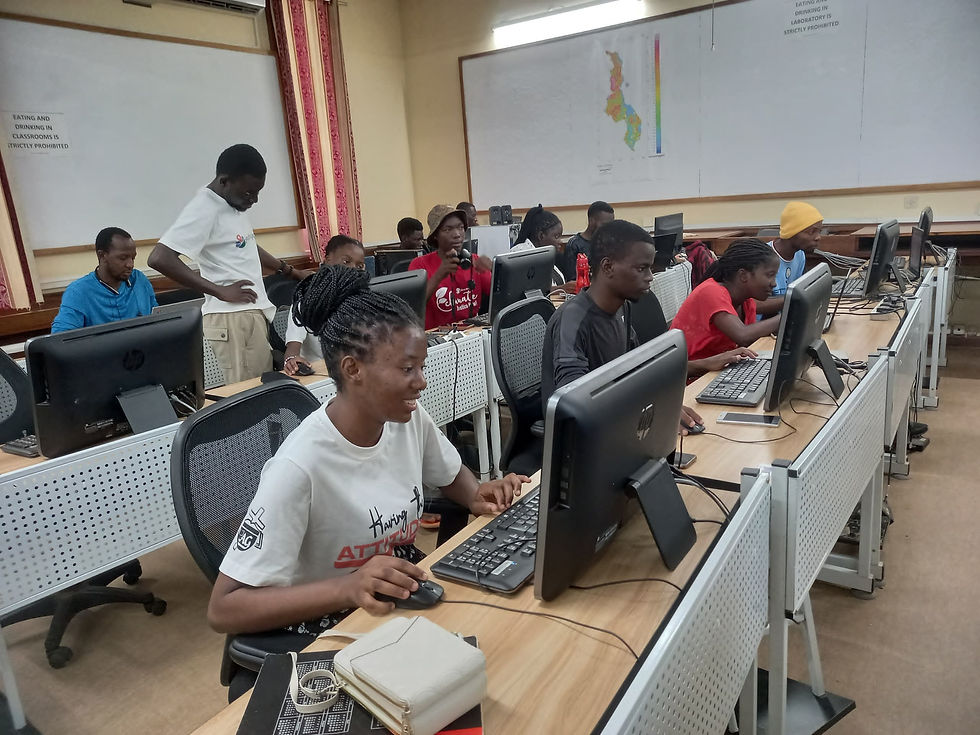
Participating in leadership skills training was a transformative experience. My involvement in the Chapter allowed me to learn and apply various mapping tools, including QGIS, iD Editor, and the HOT Task Manager. These tools equipped me with the technical expertise to contribute to impactful mapping projects. For example, using QGIS, I developed skills in spatial data analysis, while iD Editor and HOT Task Manager enhanced my ability to contribute to OpenStreetMap projects. These skills have been invaluable for both academic and professional purposes.
The JOSM training on 9th November, 2024 was very helpful. It was an online session facilitated by Ezekiel Edgar and Priscilla Kapolo, who guided us step by step on how to use JOSM to map features like roads and buildings. We practiced using real-life examples, which made the learning process easier. What I liked most was seeing many young women participating; it showed that anyone can learn mapping and make a difference. This event gave me confidence and skills to contribute to mapping projects, and it was open to everyone, including those of us who were still learning. The theme "Spatial Girls" made me feel proud to be part of a group of empowering young women in technology. This training motivated me a lot to learn more about mapping and use it to help communities. It was a great learning experience.
Planting Seeds of Change at Satema Primary School
Author: Winnious Gondwe, UNIMA Chapter Vice Secretary

UNIMA YouthMappers chapter recently had the privilege of joining the teachers and students of Satema Primary School for an exciting tree-planting event. It was more than just a typical day; it was an opportunity to bond with nature, make a meaningful impact, and witness the joy of young learners embracing an important environmental cause.
As I walked into the school, the energy was palpable. Students buzzed with excitement, holding small saplings, shovels, and watering cans. We kicked off with a brief talk on the importance of planting trees. The teachers explained how trees clean the air, cool the surroundings, and provide homes for animals. For many students, it was their first time learning about the immense benefits trees offer. Their wide-eyed curiosity reminded me of the power of simple, impactful lessons.


Then came the best part: planting. Together with a group of enthusiastic students, we dug small holes in the soil, gently placed the saplings in, and covered their roots with earth. The children eagerly took turns watering the young trees. By the end of the day, we had planted dozens of trees.
Empowering Women in Geospatial Science
Author: Kelliness Chipeta, UNIMA Chapter General Secretary
In the year 2024, I got more interested in the matters that we discussed during the Spatial Girls Network meeting, which was conducted on the 10th of October. Before I dive deep into the details of this event, I would like to first talk about myself as an individual. The first time I was introduced to YouthMappers, I never took it seriously. That was it until I, with some other girls, got invited to attend the Spatial Girls networking meeting.
What caught my attention on this day was seeing girls like me leading the session and explaining more about their experiences and how they got where they are. I was so eager to know how they managed to be there, as my gender is known to be underestimated in many areas. A lot of young ladies and a few young men attended this meeting, and yet this was my first time attending. Priscilla Kapolo, who is the co-founder and executive director of the Spatial Girls Network, elaborated more on the network. She explained that the Spatial Girls Network is a female-led organization that aims to empower and inspire girls and young women in geospatial sciences and technology to solve community and global challenges for sustainable development. She continued by saying that the organization is interested in the areas shown below:

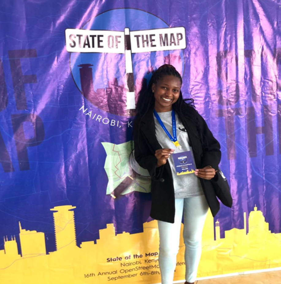
In 2024, we were privileged that our former Vice President got an award and a grant to attend the State of the Map Nairobi. She won the Spatial People Award by the Eastern and Southern Africa Hub (ESA-OMH), emerging as a star in the Mapping Women Awards (OMWA) by the Humanitarian OpenStreetMap Team. Adding on that, she was also among the organizers of, and served as chair of, the finance subcommittee in the State of the Map Malawi conference organized by OSM Malawi, where she also received a travel grant to Kenya. That was very impactful to me.
About the Authors
Maclean Nyasulu is pursuing a degree in Geography and serves as President of UNIMA YouthMappers. Aubrey Mteteka is pursuing a degree in Geography and is a member of UNIMA YouthMappers. Winnious Gondwe is pursuing a degree in Geography and serves as Vice Secretary. Kelliness Chipeta is pursuing a degree in Geology and serves as General Secretary. Tamanda Saiti is pursuing a degree in Geology and serves as Vice President of the chapter. Rhoda Mhone is pursuing a degree in Geography and serves as Vice Treasurer. All six are students and members of UNIMA YouthMappers at the University of Malawi.


Comments