
The Path of Reviving YouthMappers Chapters in Sierra Leone and Liberia
- Tommy Charles, Regional Ambassador
- Sep 16, 2021
- 3 min read
Updated: Feb 10, 2022
YouthMappers chapters are meeting points for students in different tertiary institutions across the world to connect and share knowledge and learn new things, especially things that relate to geospatial and information generation, processing, and use.
Active YouthMappers chapters benefit a lot from continuous knowledge learning and sharing activities. It helps members to acquire new skills and improve on existing ones, thereby increasing their chances of employability and pursuing higher education.
However, due to some avoidable and unavoidable circumstances, some YouthMappers chapters become inactive after their year of establishment. These circumstances range from the graduation of initial members without a chain of succession to the lack of funds to organize activities.
This has been the situation for YouthMappers chapters in Sierra Leone and Liberia, wherein all the chapters in both countries became dormant just after their establishments. Fortunately, I was given the mandate to revive them through my YouthMappers Ambassadorial appointment to the region.
Trust me, reviving dormant YouthMappers chapters is not as easy as it may sound but with team work and dedication it can be done. Therefore, I started off by setting up teams in both countries to help spearhead my drive.
I got in touch with the OpenStreetMap community in Liberia, the Liberian Red Cross Society, iLab-Liberia and YouthMappers alumnus Christian Weah. We started the preparations for three (3) mapathons to revive the chapters in Liberia.
After weeks of planning, we scheduled the mapathons to be held from the 5th to the 7th April at the University of Liberia and they were open to all existing YouthMappers and potentials in Liberia. Unfortunately, due to Covid-19 restrictions, the mapathons were cut short to two days. Even so, our goal was achieved after the two days' events. Students were reintroduced to OpenStreetMap ID Editor and JOSM and the training was facilitated by Mr. Christian Weah.
During the course of the two days events, awareness about YouthMappers was raised, persons of contacts to spearhead the revival of chapters at the Stella Maris Polytechnic, MTVC and UMU were earmarked and new YouthMappers officers and faculty advisors for the University of Liberia YouthMappers chapter were inaugurated.

YouthMappers in Liberia during a 2 days mapping training.
After the training, the YouthMappers of the University of Liberia collaborated with other students on campus to celebrate Earth Day. This was part of the suggestion for YouthMappers to collaborate with other student organizations on campus in order to expand their membership and popularize the movement.

YouthMappers of University of Liberia participating in an Earth Day event.
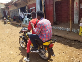
After efforts to revive the chapters in Liberia, my campaign continued in Sierra Leone. I started off at Fourah Bay College, University of Sierra Leone where we have the Students Geographic Association YouthMappers chapter. The chapter had been dormant for over a year and its revival started through the 2020 HOT Microgrant with OpenStreetMap- Sierra Leone. However, keeping the chapter active was essential and we embarked on field mapping. The members were introduced to field mapping because it is more cost effective and can be done at any time with ease. The students decided to map street trash bins and dumpsites within Freetown for three (3) days. They collected data about 155 trash bins and dumpsites after the whole exercise using Maps.me and Kobo ToolBox and uMap. Here is a map visualizing the data collected.


SGA YouthMappers collecting data about waste sites.
After the revival of their chapter, the SGA YouthMappers participated in the Power Grid Mapping project by capturing and uploading images using Mapillary. They did so within a week and collected over 10,000 images.
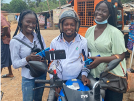
SGA YouthMappers participating in the Power Grid Mapping project.
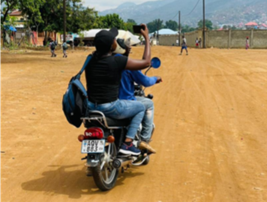
My campaign continued to the Northern part of Sierra Leone where there are two chapters: the Canadian College YouthMappers and University of Makeni YouthMappers at the Canadian College of Technology and University of Makeni respectively. Both were established during the peak months of the Covid-19 pandemic therefore they had not received thorough field mapping training and data collection. Both chapters decided to map health facilities and learning institutions. The mapped 144 learning institutions in Makeni and Mile 91.

YouthMappers chapters in Sierra Leone are currently participating in the Power Grid Mapping project which is enabling them to practicalize some of the skills and technology they have been introduced to. Together we are mapping buildings and roads and this data will be used for electrification planning as part of a larger project with researchers at Arizona State University to support the design of power distribution networks.

My journey is far from over as there is a goal to build an army of data enthusiasts equipped with all the necessary skills. This is becoming a reality through the effort and support of the YouthMappers. We say thanks.
Learn more about the Mapping Power campaign here!


Comments