
YouthMappers Fellows Action in DRRM and Anticipatory Actions
- Nishan Kumar Aryal
- May 4
- 4 min read
Acknowledgment: This post was delayed in publication and may contain outdated information. We appreciate your understanding

Disaster response and rescue operations in Nepal improved after a major earthquake hit the country in 2015. Several organizations in the country have been working to strengthen the response and rescue operations in any fortunate incidents. Following a recent earthquake that hit Jajarkot, a rural district of Nepal, the YouthMappers community in Nepal also showed active participation in disaster management and reporting of the prevalent condition.
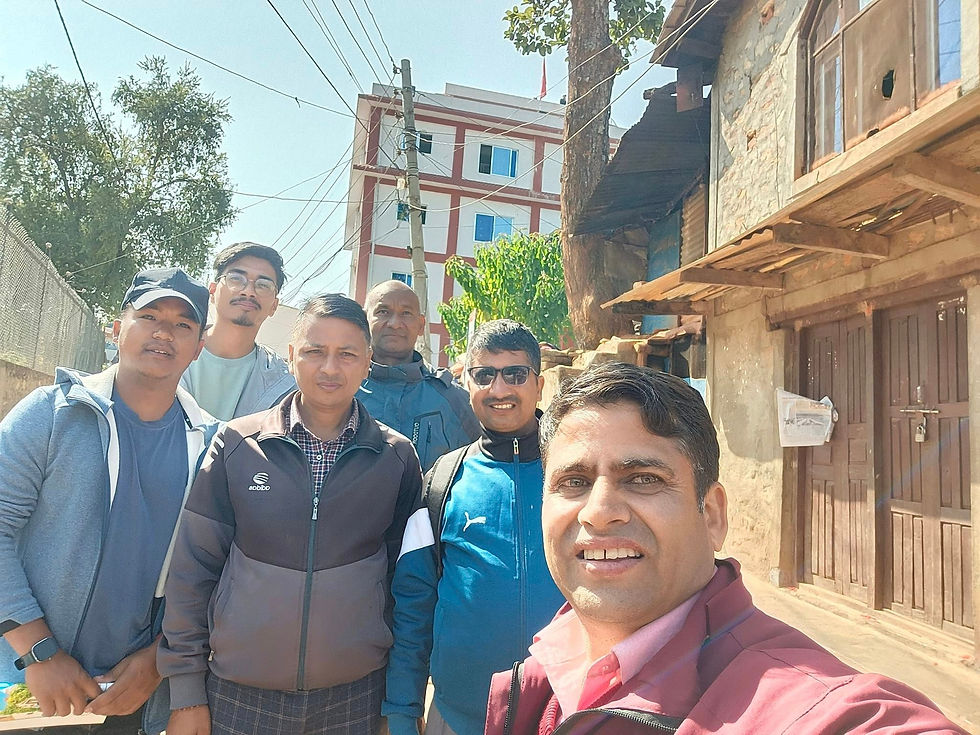
Under the guidance of Nishan Kumar Aryal, a YouthMappers Regional Ambassador in Asia, YouthMappers in Nepal demonstrated the power of anticipatory actions and the importance of coordinated disaster risk reduction and management (DRRM). In this blog, we have highlighted the crucial role of knowledgeable mapping enthusiasts like YouthMappers fellows as well their efficient collaboration with other related organizations to enact timely and effectively manage a crisis such as the Jajarkot Earthquake 2023.
What were the Anticipatory Actions of the YouthMappers Community?
With a magnitude 5.7 Richter scale, a massive earthquake hit the Jajarkot district at 11:47 pm on the night of November 3, 2024, killing 153 people and injuring at least 375 people right away. The following morning, YouthMappers Nepal initiated an emergency meeting with OpenStreetMap (OSM) Nepal, Kathmandu Living Labs, Innovation Lab, and the OpenTech Community. Every fellow member involved had a clear objective, which was, to support the Jajarkot earthquake response team through comprehensive mapping tasks. This collaboration of multiple organizations with a common objective outlined the critical role of anticipatory actions in disaster scenarios, enabling rapid mobilization and efficient resource allocation.
Information Validation from Field Surveys
Information and data from the field are pivotal in crisis situations as one can act on rescue operations only after knowing the exact statistics from the field. In order to navigate the situation of the affected location, Jajarkot after the earthquake, the YouthMappers team leveraged tools like KoboCollect to gather accurate and real-time data from the affected areas and its neighboring landmarks.
The tool is well renowned for its efficient collection of mapping data even in remote areas which is why we used it too. Truly, KoboCollect proved its worth as an instrumental tool for ensuring reliable and up-to-date information for making decisions during rescue operations. Apart from guiding the rescue, the tool was equally crucial in generating situational GIS reports that guided further response efforts.
Coordination with Different Organisations in the Field
An effective disaster response or management of crisis aftereffects is not the task of a single person but a joint effort of many concerned bodies. It requires seamless coordination between different stakeholders to manage a crisis effectively. That's why YouthMappers worked in close coordination with a Nepali organization called Disaster Preparedness Network (DpNet) Nepal, local government as well as private organizations.

In this association, Dr. Raju Thapa representing DpNet Nepal, played a key role in facilitating this collaboration as well as ensuring available resources were used to their maximum potential and efforts were not duplicated unnecessarily. Undoubtedly, this partnership was vital in addressing the immediate needs of people affected by the catastrophic event in Jajarkot.
GIS Surveys and Their Role in DRR

GIS surveys conducted in the affected areas were another major anticipatory action of the YouthMappers fellows during the Jajarkot Earthquake 2023. A team of surveyors led by Nishan K. Aryal including Amrit Kumar Aryal, Hemanta Maratha, and Ramhari KC conducted a GIS survey to identify the severely affected areas in the Jajarkot district with a motive of prioritizing response efforts where required. From these surveys, our YouthMappers fellows derived detailed maps that highlighted damaged infrastructures, road blockages, and areas with critical needs.

These maps helped segregate the relief funds based on the requirements and urgencies. Several organizations such as DpNet and other local/governmental organizations used these situational reports generated from the GIS surveys to plan and execute relief operations effectively.
Enthusiasm in YouthMappers: The Aftereffect of Disaster Response
The Jajarkot earthquake was not just an event showcasing the role of mappers in effective disaster rescue, response, and management of critical situations. It was also a display of that zeal in YouthMappers to become helpful in a situation of urgency or need. The series of swift efforts and proactive approaches made by our fellows showed their enthusiasm and dedication to the rescue work.
However, the rescue operations were not just limited to the fields; some even worked their way out away from the disaster location to fasten the course of action. One such YouthMapper fellow, Ashok Thakulla actively designed anticipatory action for DRR in collaboration with local governments and private organizations. His efforts were crucial in ensuring all preparatory measures were in place and in minimizing the impact of the earthquake on vulnerable communities.
Ashok Thakulla was one of the participants in YouthMappers Fellow Summit 2023 and he used the information gained through interactions and sessions in the summit for field action.
Supporting DRRM Activities in Jajarkot
Similarly, a few passionate YouthMappers supported DRRM activities in Jajarkot remotely by providing critical information and data where required. Lalit Bc is one such passionate YouthMapper who provided a detailed mapping of Western Nepal to aid the analysis of the situation of Jajarokot and its neighboring districts after the disaster. These pieces of information were very crucial to enacting relief efforts as well as to support the reconstruction process of the affected areas and communities.
The intensive work done by these mappers is well evident on the Facebook page of our YouthMapper fellow Ashok Thakulla. The posts also give a glance at the extensive work done in DRMM mapping and the positive impact of their contributions.
Coming to the Conclusion
Summing up, the earthquake in Jajarkot highlighted how the anticipatory actions of mappers can ease the disaster response with correct data, efficient communication of information, and much more.
Through effective coordination, accurate data collection, and enthusiastic participation, YouthMappers demonstrated how community-driven efforts can make a substantial difference in crisis management. Their collaboration with organizations like DpNet Nepal and the use of innovative tools like KoboCollect exemplify the power of technology and teamwork in enhancing disaster resilience.
Now, we call out to all young mapping enthusiasts to join the YouthMappers community to make an impact on DRMM initiatives. Your participation will certainly help to build more resilient communities and lives in case such disasters hit your region again.
About the Author
Nishan Kumar Aryal was a YouthMappers Regional Ambassador for Asia Pacific Region- Community Engagement.


tag game is perfect for quick entertainment, with short rounds that are always full of tension and laughter.
Great to see Nepal's YouthMappers community responding so actively after the Jajarkot quake. How can individuals get involved in DRRM training and anticipatory actions through these chapters? I've been using https://3d-ai-generator.com
Nepal's 2015 quake showed how crucial preparedness is for Jajarkot's remote districts. YouthMappers' community-led reporting is exactly the kind of local capacity building that makes anticipatory action work. I've been following their field updates. https://hailuo-ai.pro
YouthMappers' local response in Jajarkot after the 2015 Nepal quake really shows why community-led disaster management matters. I've been using https://fruit-love-island.com
Love seeing YouthMappers Nepal's hands-on response to the Jajarkot quake! How do chapters get involved in anticipatory action training like that? I've been using https://aivideomemegenerator.com