
YouthMappers in Action: Community Mapping Project in Adamawa State-Empowering Youth, Enriching Communities
- Adamu Muhammad Adamu
- 4 hours ago
- 6 min read
Acknowledgement: This post was delayed in publication and may contain outdated information. We appreciate your understanding.
Returning with Purpose
After being selected as a YouthMappers representative from Nigeria to attend the prestigious 2024 YouthMappers Leadership Fellowship Summit in Thailand, I returned home with renewed drive and passion to document my experience and inspire others. The summit was not merely an event; it was a transformative experience. Surrounded by passionate individuals from across the globe, I developed a deeper appreciation for the power of mapping in addressing real-world challenges. I subsequently shared the knowledge and skills acquired at the summit with YouthMappers chapters across Nigeria and the wider continent.

My journey began with participation in virtual programs and conferences where I shared my YouthMappers experiences and mapping expertise, emphasizing their transformative potential. These platforms enabled me to inspire others and spark curiosity among aspiring YouthMappers. Back at Gombe State University, as a dedicated member and leader, I collaborated with my executive team to integrate YouthMappers into the academic fabric of the university, including outreach to newly admitted students to inspire this new cohort.

As Vice President of the National Association of Geography Students (NAGS), I had a unique platform to influence and motivate students. In collaboration with my committee, I organized an orientation program that reached students across various departments. I led sessions introducing YouthMappers, discussing its history, achievements, and the ways in which the organization supports professional development. I also shared my personal success story with YouthMappers, including my travel experience to Thailand. This resonated deeply with the audience, and students from diverse disciplines soon expressed strong interest in joining our chapter.
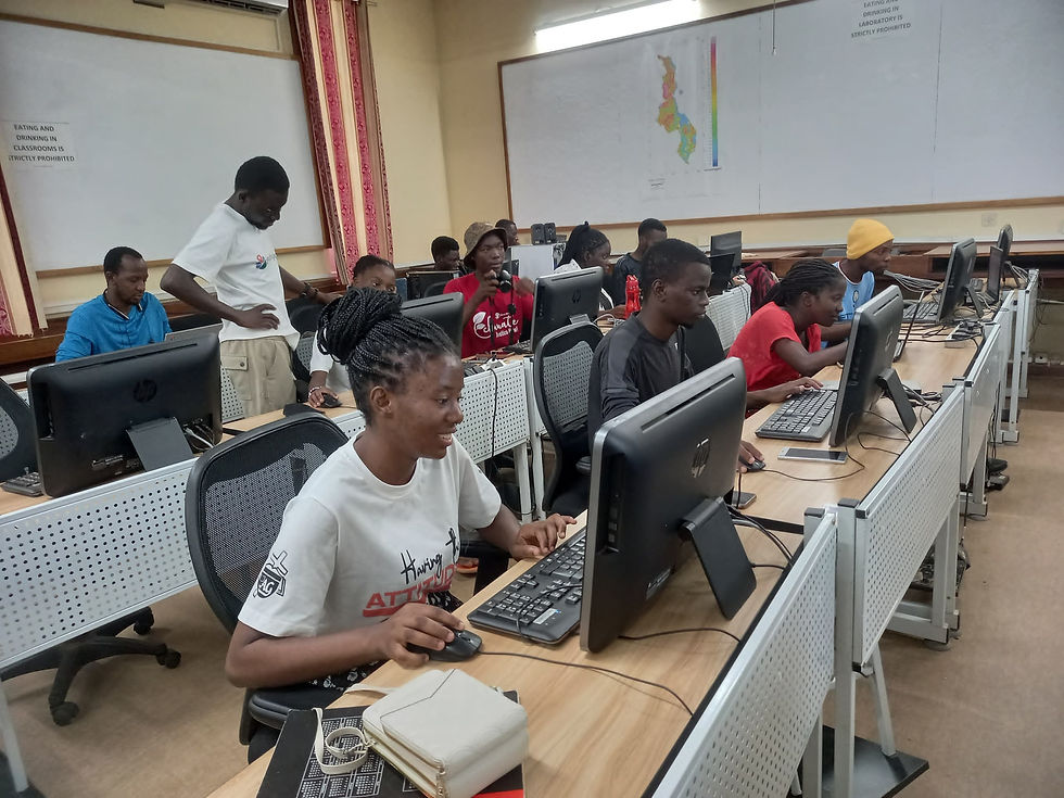
Following the orientation, students from multiple departments joined the chapter. I equipped them with mobile devices and applications and trained them to contribute to OpenStreetMap. We achieved significant milestones, and it was encouraging to see students accord YouthMappers the same seriousness as their academic commitments. Their dedication inspired me to think beyond a single chapter; it had become a movement.
The Genesis of the Community Mapping Project
During one of our brainstorming sessions, I proposed an ambitious idea — a community mapping project aimed at addressing pressing local issues. The timing aligned perfectly with the compulsory Field Study course in the Geography Department, which included a planned trip to Adamawa State. This presented an opportunity to integrate academic learning with impactful community service. With the full support of the YouthMappers steering committee, we selected Adamawa State as our focus. The project had a dual purpose: to promote the YouthMappers mission in underrepresented areas and to address socio-environmental challenges through data-driven solutions.
Day 1: A Scenic Journey Through Northeastern Nigeria—From Gombe State University to Numan

The journey from Gombe State University was more than a physical trip; it was a passage through the diverse landscapes of northeastern Nigeria. As we departed Gombe, expansive savannah grasslands stretched ahead, interspersed with farmland in shades of green and gold. Along the route, farmers tended their fields, herders guided their cattle, and children played along dusty roads, reflecting the vibrancy of rural life.
Approaching Kaltungo and Billiri, the terrain gradually transformed into rolling hills and then the imposing Kaltungo Hills. These formations stood as powerful natural landmarks. Passing through these towns, I observed the resilience of the Tangale and Tula people, who have preserved their cultural heritage despite challenges such as deforestation and climate change.
We continued to Lafiya Lamurde, a secluded village where life moved at a gentler pace. The landscape transitioned into the lowlands of Adamawa State, signaling our arrival in Numan. Situated along the Benue River, Numan welcomed us with historical depth and natural beauty. The river’s shimmering waters underscored its importance as a regional lifeline, while visible sedimentation and erosion hinted at the environmental challenges ahead.
This journey was not simply travel from one location to another; it was an immersion into the landscapes and livelihoods of northeastern Nigeria. Upon arriving in Numan, I felt a strong sense of purpose. This was not just a field trip but an opportunity to engage communities, understand their challenges, and contribute meaningfully.
Day 2: Mapping Kwakwambe Village and Conducting a Census

The second day took us to Kwakwambe, a small riverside village that appeared largely untouched by time. As we arrived, children ran barefoot along dusty paths while women carried out daily chores beneath the shade of trees. The scene was peaceful, yet it concealed significant challenges.
Kwakwambe’s economy is primarily based on fishing and agriculture, with the river central to daily life. During the rainy season, however, flooding displaces families and forces them to seek refuge in neighboring communities. We observed mud houses with thatched roofs marked by visible flood damage. Residents spoke of resilience and loss, describing a recurring cycle of rebuilding each dry season. One elder referred to it as a cycle of hope and heartbreak.
Our census and mapping activities documented key village features, including housing, agricultural fields, and shared facilities such as the school and clinic. Community discussions revealed that the school, already under-resourced, becomes inaccessible during floods when it is most needed. These insights underscored the importance of our work. The exercise extended beyond mapping and data collection; it was about contributing to a future in which residents would no longer need to rebuild their lives annually.
Day 3: Ngurore Market—A Hub of Culture and Commerce

Ngurore Market was our next focus, presenting a vibrant and dynamic atmosphere. As we approached, the air was filled with the scents of fresh produce, roasted meat, and spices. Traders and customers animated the market with negotiation, conversation, and laughter, creating a vivid expression of Adamawa State’s commercial and cultural life.
The market layout reflected organized complexity. Livestock traders occupied one section, with goats, sheep, and cattle creating a lively soundscape. Nearby, farmers displayed tomatoes, onions, and millet in colorful arrangements. Artisans showcased handicrafts, textiles, and household goods, each stall reflecting ingenuity and resilience.
Our task was to map the market’s layout, characteristics, and movement patterns using tools such as KoboCollect and Mapillary. We engaged traders and customers to understand their experiences. One trader, a woman in her late forties, explained how income from selling woven baskets had enabled her to educate her children, illustrating the transformative potential of small-scale trade.
By the end of the day, our data captured the market’s complexity and significance. Ngurore Market emerged not only as a center of commerce but also as a space of social connection and opportunity. Mapping it felt like preserving an essential part of Adamawa’s identity.

Day 4: Surveying Numan Metropolis and the Numan River
The final day focused on Numan’s urban environment and the river that shapes its character. Numan is a town in transition, with new buildings emerging alongside older structures, busy roads, and a blend of traditional and modern markets. At the same time, challenges such as inadequate road infrastructure and housing congestion highlighted the pressures of urban growth.

In the afternoon, we turned our attention to the Numan River, an essential resource for the city and surrounding communities. Standing along its banks emphasized its historical and economic importance. The Benue River, originating from the Adamawa Plateau in Cameroon, flows through Nigeria before joining the Niger River. In Numan, it supports fishing, farming, and transportation, while also posing risks such as seasonal flooding.
Mapping the river was both informative and sobering. We documented its course, flood-prone areas, and nearby settlements. Conversations with local fishermen revealed concerns about declining fish stocks due to overfishing and pollution. One fisherman remarked that the river is both life and death.

As we concluded our work, I felt a strong sense of fulfillment. The project deepened our understanding of the region while reinforcing the need for sustainable, data-driven solutions. Our experience in Adamawa State demonstrated how youth-led mapping initiatives can support community resilience and informed decision-making.
About the Author
Adamu Muhammad Adamu is a third-year Geography student at Gombe State University, Nigeria, and President of his university’s YouthMappers chapter. He is passionate about using mapping to address challenges like climate change, infrastructure gaps, and community resilience.
As a 2024 YouthMappers Leadership Fellow, representing Nigeria at the Leadership Summit in Thailand, Adamu gained global insights into geospatial technology and its role in sustainable development. He is dedicated to mentoring young mappers and implementing projects that empower underserved communities through actionable data and innovation.


Comments