
Attending the 2018 YouthMappers Research Fellowship Workshop
- Ingrid Martha Kintu, Makerere University
- Jun 22, 2018
- 4 min read

From 3rd to 15th of June 2018, the selected student-mentor teams from different parts of the world, of which I was part, convened in the United States of America for a research methodology symposium. The first leg was held at The George Washington University (GWU) and the second at West Virginia University (WVU).
While at GWU, the workshop started with cordial introductions and then followed by a video conference call with the 2017 YouthMappers Leadership Fellows. The fellows gave insights into how their fellowship had a great impact on them and how they have used what they learnt in their day-to-day activities which I personally found to be very inspiring. They also shared the challenges they have faced and how they managed to overcome them. This was followed by the alluring student presentations during which constructive feedback was given by the training team.
We had the opportunity to visit the United States Agency for International Development (USAID) GeoCenter where we were welcomed by the Chief Geographer and Director, Ms. Carrie Stokes, who gave an inspiring talk. The teams learnt about the work USAID has done over the years such as understanding child migration in Central America, food consumption and stunting in Bangladesh, political polarization in Zambia, and many others. An interactive session was held in which we engaged with the USAID GIS specialists and shared our work with them. We also got to meet Mr. Michael McCabe, the Agency Youth Coordinator, who is responsible for development issues regarding youth and advocates for and integrates youth into the Agency’s initiatives.


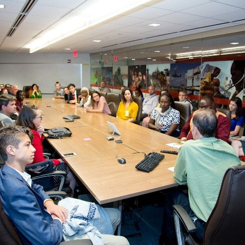
Ms. Carrie Stokes giving a welcome note (top photo), Student-mentor teams engaging with a USAID GIS analyst (left), Mr. Michael McCabe, the USAID Youth Coordinator addressing the teams (right)
We had the privilege to go to World Bank offices where we met Mr. Tyler Radford, the Executive Director of the Humanitarian OpenStreetMap Team (HOT). Mr. Radford gave a very informative talk on the work HOT is doing in Uganda and Tanzania among others. In this talk, he mentioned that ‘HOT is many things, volunteers working together and that HOT is YouthMappers’. Other interesting sessions were held including one on Disaster Risk Management by Mr. Vivien Deparday (Open Data for Resilience Initiative), an interactive gender exercise by Ms. Mira Gupta (Open Data for Resilience Initiative) and a talk from Ms. Sarah Antos from GOST (Geospatial Operations Support Team).


Mr. Tyler Radford, ED of HOT addressing the teams (top left), Mr. Vivien Deparday, OpenDRI DRM specialist (top right), Ms. Mira Gupta chairing the gender discussion (bottom left), Ms. Sarah Antos talking to the teams (bottom right)
Later in the day, the students gave three minute lightning talks about their work to Geo DC, a meetup group for those in the DC area who like maps, GIS, OpenStreetMap, cartography and anything in between.


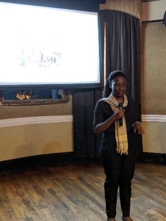


Mr. Chad Blevins addressing GeoDC members (top left), Ms. Ingrid Martha Kintu giving a lightning talk (top right), The YouthMappers Research Fellows (bottom left), Group photo with the Geo DC members (bottom right)

We also visited MapBox, learned about their work, how they contribute to humanitarian causes, and how to use their tools to make beautiful maps.
Over the span of time spent at GWU, a lot of knowledge was imparted on us that is, on how to develop a research proposal and the use of various tools such as Radiant Earth, ESRI Story Maps, Field Papers, KOBO toolbox, QGIS, InaSAFE, JOSM, and OSM validation.
Mr. Mikel Maron talking to the teams
On 10th June 2018, the workshop moved to West Virginia, a state with a wholly different atmosphere from Washington, DC. The preceding days involved comprehensive practical sessions on data analytics and geostatistical analyses held by Prof. Jamison Conley from WVU. Other skills such as app development, the use of OSM in ArcGIS, the best practices of community engaged research, data ethics and Human Subjects were explored.
The students were required to make final presentations on the improvements they will apply to their work as a result of all that was shared throughout the workshop. Certificates of recognition were also handed out to the individual teams. However, this workshop wasn’t all work and no play. Rather, while in Washington DC, the teams had the opportunity to tour the city on a free day that was arranged within the workshop schedule. Also while in West Virginia, an outing to the WVU Forest with the GWU Geography Department drone and a hike to Cooper’s Rock were organized. Not to mention the tasty food we ate all the while. A major shout out to Prof. Brent McCusker for all the delicious food recommendations he made!


Fellows at the Washington Monument (right), Group photo at Cooper’s Rock, WV (left)

Group selfie during the drone exercise at the WVU Forest
In its entirety, this workshop had a very big impact on me. It was an avenue to meet new people from different cultures, share ideas, and make long lasting friendships and contacts. Being an undergraduate student, I have always wondered which career path I should pursue given how diverse land surveying and geomatics is. However, this experience has enabled me to concretize my career path as that of being a geospatial analyst for humanitarian causes. I am extremely grateful to YouthMappers and USAID for this opportunity. I would like to specially thank Prof. Patricia Solis, Prof. Brent McCusker, Prof. Nuala Cowan, Prof. Richard Hinton, Prof. Ryan Engstrom, Prof. Jamison Conley, Mr. Chad Blevins, Ms. Marcela Zeballos, Ms. Michelle Bester and Ms. Nina Feldman for all the help and knowledge they imparted to us. I also want to thank all the mentors for the guidance they accorded us. I am eternally grateful and confident that all the teams will successfully accomplish their projects.
Ingrid Martha Kintu is a student of Land Surveying and Geomatics under the School of Built Environment at Makerere University in Kampala, Uganda. She had the opportunity to be trained in the use of OSM tools and since then, she has used these skills to train others in the GeoYouthMappers chapter at Makerere University. She is very passionate about creating open data and organizing any activity that involves mapping for humanitarian causes. Ingrid is also a 2018 YouthMapper Research Fellow looking to map for community resilience within Kyaka II refugee settlement in Kyegegwa, Uganda. She is determined to continue educating others about GIS applications and working with the mapping community.


Comments