
Diary of a Regional Ambassador: Travel and Work Flow
- Kwame Odame, Regional Ambassador
- Jun 18, 2020
- 3 min read
Updated: Oct 15, 2020
While Ghana could boast of 6 YouthMappers chapters, which are mainly concentrated along the south of the country, the opportunity to serve as the regional ambassador presented an avenue to balance the distribution of chapters and also extend the footprint of YouthMappers across Ghana. This responsibility did not come easy since the concept of voluntary services was not attractive to many students and students usually shy from such conversations. While navigating this challenge, the surest way I saw of changing the redistribution of chapters was to primarily fall on campuses or student groups that had a geographical inclination, as well as, rely on the existing OpenStreetMap community in Ghana. In the midst of rejections, I successfully engaged 4 campuses who joined the community
The Trips

Visiting campuses was an interesting part of my duty as a regional ambassador, since a face to face interaction with prospective students had the tendency of creating a much longer relationship than a virtual meeting. Unfortunately, I had spent a greater proportion of my life in 2 out of 16 regions in Ghana but the excitement of meeting these students was enough to embark on these trips. My first trip was to the University for Development Studies; this was the most enduring trip since it required an 18-hour bus ride and a total traveling distance of 786 kilometers. Though both students and faculty regularly called
to check on me, this trip also offered the chance to explore the country side and also add OSM data using CompleteStreet and OsmAnd. Other trips were shorter (6-8-hour bus ride) but also eventful. At one point, my bus to the Valley View University broke down in the middle of nowhere and I had to pay for another bus since the drivers refused to reimburse us (we don’t usually get reimbursement in long distance trips). At another point, I boarded the wrong vehicle to Ashesi University but also learnt an important lesson; verify local knowledge!

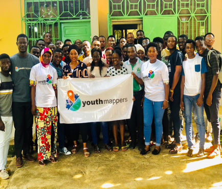

Group picture with students from the JOSM training session for students from the
University for Development Studies Ashesi University
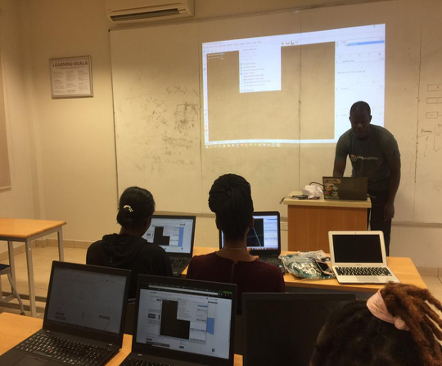
Arrival and interaction with students and facility
My first interaction with students always began with ‘Map the difference’ campaign video from Humanitarian OpenStreetMap Team (HOT), since it offers a more convincing message on how voluntary services within the OSM community increases visibility of vulnerable populations. The format of our OSM training sessions was largely dependent on the conditions of these campuses, and this was largely determined by the presence of reliable campus internet service and a computer lab since some students did not own laps. Usually, the training sessions begins with an introduction to HOT Tasking manager, JOSM, KoBo collect and OsmAnd. While using the tasking manager, students map their campus and other adjourning communities, since local knowledge enables students to apply the needed presets and also appreciate their contribution in putting their campus on the map. In some cases, the focus was rather on the mobile mapping platforms since access to computers and internet services was quite a challenge for some students. At the end of every training session, I assigned a local community for students to map. This was intended to test their mapping proficiency and also offer the needed feedback. To make the interactions exciting for students, I offered YouthMappers branded souvenirs like T-shirts and stickers to students who correctly answered trivial questions relating to YouthMappers activities during the interactions, and this heightened the excitement in our interaction. Below and linked here are some videos of student’s assessment to our interaction and I hope you enjoy it.
Post interactions
While returning to Cape Coast, I pondered on effective ways to improve students mapping efforts and contributions to OSM. By this, students still expressed their interest in mapping various local communities since data in that part of the country was mostly unavailable. While working with students to achieve this task, disruption of the academic calendar due to emergence of COVID-19 haltered students gathering including YouthMappers mapathons. As a way of keeping students engaged, I have successfully organized two virtual mapathons in an attempt to map key hotspot zones in Ghana. The inclusion of Rebecca Firth and Chad Blevin’s as key speakers in these virtual mapathon saw the addition of 8,000 buildings and moved Ghana to the top spot among the highest contributing countries to OpenStreetMap. I am excited to see how far I have come and would write another blog to highlight the challenges I endured in my capacity as a Regional Ambassador.

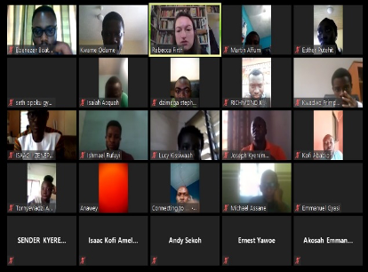

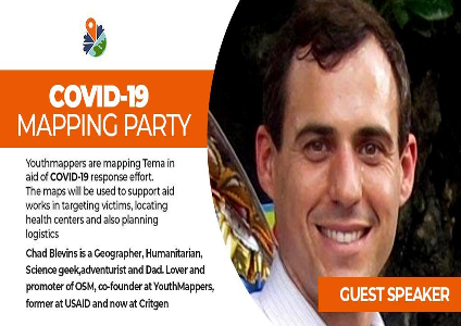
Zoom meeting with Rebecca from HOT for Poster for second virtual mapathon
first virtual mapathon


Comments